4 Essential Maps of India for Travelers
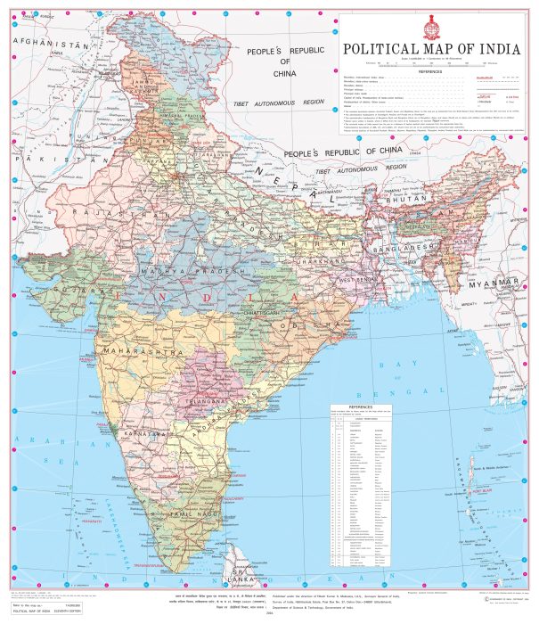
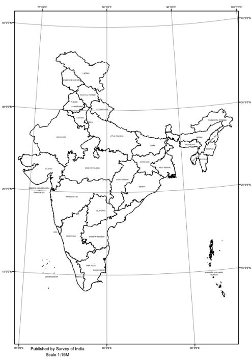
Explore India’s fascinating geography with our 4 essential Maps of India. Plan your journey through 28 states and 8 union territories (as of July 2024), from the Himalayas to tropical beaches.
India’s Geography: A Traveler’s Guide
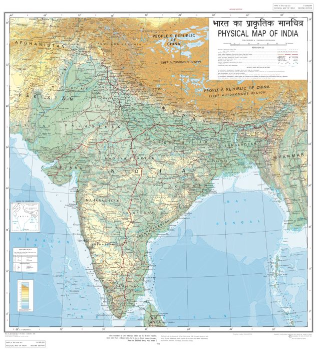
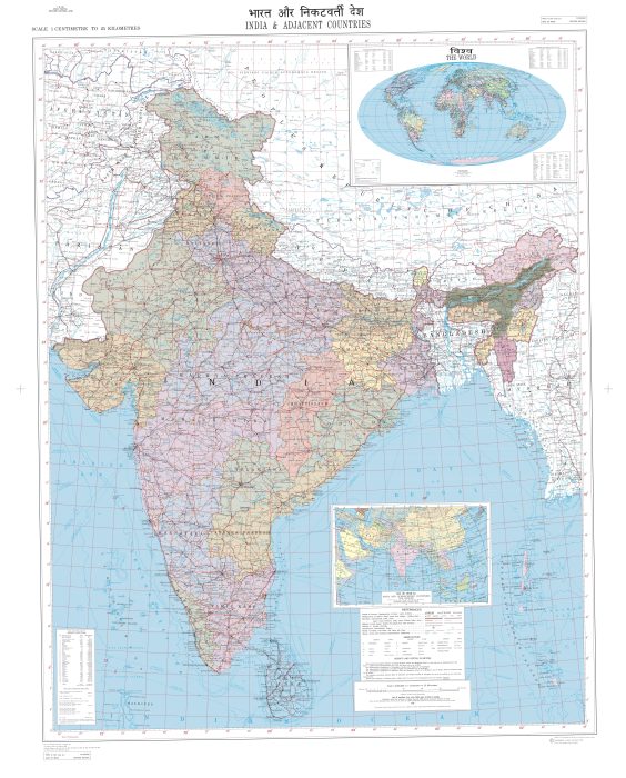
Maps of India are indispensable tools for travelers exploring this vast and diverse country. Our page features four essential maps that provide valuable insights into India’s geography, political divisions, and regional context. These maps serve as a window into the incredible variety of landscapes, cultures, and experiences that India offers.
Majestic North
Northern India is dominated by the awe-inspiring Himalayan range. This colossal mountain system includes some of the world’s highest peaks, creating a natural barrier that has shaped India’s climate and culture for millennia. The Himalayas are not just a feast for the eyes; they’re also the source of major river systems like the Ganges and Brahmaputra, which have nurtured civilizations for thousands of years.
Travelers to this region can explore picturesque hill stations like Shimla and Darjeeling, or seek spiritual enlightenment in Rishikesh and Haridwar. The state of Ladakh, with its high-altitude deserts and ancient Buddhist monasteries, offers a unique landscape that seems almost otherworldly.
Central Plains
Central India, encompasses vast plains and plateaus, including the fertile Indo-Gangetic region. This area is often referred to as India’s heartland, both geographically and culturally. The Ganges River and its tributaries have created a wide, flat plain that has been the center of Indian civilization for centuries.
This region is home to important historical cities like Varanasi, one of the oldest continuously inhabited cities in the world, and Lucknow, known for its elaborate architecture and culinary traditions. The central Indian state of Madhya Pradesh boasts numerous wildlife reserves, including Bandhavgarh and Kanha, where visitors can spot Bengal tigers in their natural habitat.
Western Deserts and Eastern Jungles
India’s geography becomes even more diverse as we move east and west. The western part of India features the Thar Desert in Rajasthan, a region famous for its colorful culture, magnificent palaces, and unique ecosystem. Despite its harsh climate, the Thar Desert supports a variety of wildlife and offers visitors unique experiences like camel safaris under starlit skies.
In stark contrast, eastern India is characterized by lush forests and rolling hills. The states of West Bengal and Assam are known for their verdant tea plantations, while the Sundarbans delta, shared with Bangladesh, is home to the largest mangrove forest in the world and the elusive Bengal tiger.
Tropical South
Southern India, presents yet another face of this diverse country. Characterized by a tropical climate, this region features palm-fringed beaches, lush backwaters, and the Western Ghats mountain range. The Western Ghats, running parallel to India’s western coast, is a biodiversity hotspot and UNESCO World Heritage site.
Kerala, often called “God’s Own Country,” is famous for its serene backwaters, Ayurvedic traditions, and spice plantations. Tamil Nadu boasts ancient Dravidian temples with towering gopurams, while Karnataka is home to the ruins of Hampi, once the capital of a mighty empire.
India in the Regional Context
Map of India and its adjacent countries provides a broader perspective, showcasing India’s strategic position in South Asia. Bordered by the Arabian Sea, Indian Ocean, and Bay of Bengal, India’s coastline stretches over 7,500 kilometers, influencing its climate and fostering a rich maritime history.
India shares land borders with seven countries: Pakistan, China, Nepal, Bhutan, Bangladesh, Myanmar, and Afghanistan (through Pakistan-occupied Kashmir). This geographical positioning has played a crucial role in shaping India’s history, culture, and geopolitics.
Climate and Seasonal Considerations
India’s diverse geography results in a wide range of climatic conditions. The country experiences four main climatic patterns: tropical wet, tropical dry, subtropical humid, and montane. The monsoon, a defining feature of India’s climate, typically occurs from June to September, bringing much-needed rainfall but also potential travel disruptions.
Understanding India’s geography and climate is crucial for planning your trip. Whether you’re seeking the snow-capped peaks of the Himalayas, the sun-drenched beaches of Goa, the lush tea gardens of Darjeeling, or the historical wonders of the Golden Triangle, Maps of India will help you navigate this incredible country.
From bustling metropolises to serene countryside, ancient monuments to modern marvels, India offers a lifetime of experiences. Let maps of India be your guide as you embark on an unforgettable journey through one of the world’s most diverse and captivating destinations.


